
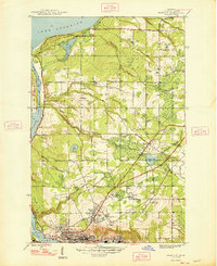
1948 Map of Hancock
USGS Topo · Published 1948About this map
The industrial and maritime heritage of the Keweenaw Peninsula is evident in this mid-century survey of the terrain between Lake Superior and Portage Lake. Copper mining operations dominate the southern portion of the sheet, centered around the Franklin Mine and the settlement at Pewabic. The town of Hancock serves as the regional hub, situated on the slopes above the water with institutional anchors like Suomi College and St Joseph Cem.
Find a feature on this map
40 named features on this map. Tap any name to fly to it.
Don’t see what you’re looking for? This feature index may not catch every label — zoom into the map to look around manually.
Map Details
Editions of this 1948 Hancock Map
2 editions found
Other maps of this area

1915 · Houghton
USGS Topo · 1:62,500

1941 · Ahmeek
USGS Topo · 1:31,680

1946 · Hancock
USGS Topo · 1:24,000

1946 · Chassell
USGS Topo · 1:24,000

1946 · South Range
USGS Topo · 1:24,000

1946 · Muggun Creek
USGS Topo · 1:24,000

1946 · Ahmeek
USGS Topo · 1:24,000

1946 · Laurium
USGS Topo · 1:24,000

1947 · Ahmeek
USGS Topo · 1:24,000

1948 · South Range
USGS Topo · 1:24,000