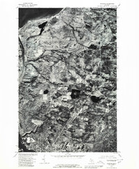
1978 Map of Hancock
USGS Topo · Published 1980About this map
Hancock and the neighboring community of Ripley anchor this orthophotoquad, which uses aerial photography from October 1978 to document the Keweenaw Peninsula's landscape. The imagery provides a clear view of the concentrated street grids in the south compared to the rural inland settlements of Paavola and Boston. This particular survey is notable for its depiction of the Portage Lake Ship Canal, showing the vital waterway cutting north toward Lake Superior. The transition from the dense urban development along Portage Lake to the agricultural and forested patches further north highlights the region's mid-century spatial organization. Small drainages like Muggun Creek are visible as they meander through the varied terrain, offering researchers a literal snapshot of land use before subsequent modern developments changed these Copper Country communities.
Find a feature on this map
8 named features on this map. Tap any name to fly to it.
Don’t see what you’re looking for? This feature index may not catch every label — zoom into the map to look around manually.
Map Details
Editions of this 1978 Hancock Map
This is the sole edition of this map. No revisions or reprints were ever made.
Other maps of this area

1915 · Houghton
USGS Topo · 1:62,500

1941 · Ahmeek
USGS Topo · 1:31,680

1946 · Hancock
USGS Topo · 1:24,000

1946 · Chassell
USGS Topo · 1:24,000

1946 · South Range
USGS Topo · 1:24,000

1946 · Muggun Creek
USGS Topo · 1:24,000

1946 · Ahmeek
USGS Topo · 1:24,000

1946 · Laurium
USGS Topo · 1:24,000

1947 · Ahmeek
USGS Topo · 1:24,000

1948 · South Range
USGS Topo · 1:24,000