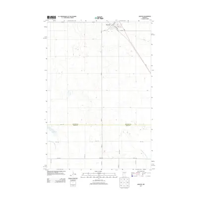
2013 Map of Hancock
USGS Topo · Published 2013About this map
Hancock serves as the primary settlement on this landscape, positioned where the grid of city streets meets the angled path of MN 9. This 2013 survey illustrates the agricultural character of the region, defined by an extensive network of drainage infrastructure like Judicial Ditch Number Sixtythree and Judicial Ditch Number Nine. The town center is detailed with locally significant markers, including the Po, and a street plan anchored by Atlantic Ave, Pacific Ave, and Hancock Ave.
Find a feature on this map
37 named features on this map. Tap any name to fly to it.
Don’t see what you’re looking for? This feature index may not catch every label — zoom into the map to look around manually.
Map Details
Editions of this 2013 Hancock Map
This is the sole edition of this map. No revisions or reprints were ever made.
Other maps of this area

1912 · Morris
USGS Topo · 1:62,500

1953 · Saint Cloud
USGS Topo · 1:250,000

1957 · Saint Cloud
USGS Topo · 1:250,000

1958 · Saint Cloud
USGS Topo · 1:250,000

1968 · Cyrus
USGS Topo · 1:24,000

1968 · Danvers
USGS Topo · 1:24,000

1968 · Hancock
USGS Topo · 1:24,000
1968 · Hancock SW
USGS Topo · 1:24,000
1968 · Clontarf North
USGS Topo · 1:24,000
1968 · Hancock NW
USGS Topo · 1:24,000