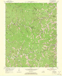
1954 Map of Handshoe
USGS Topo · Published 1971About this map
The rugged intersection of Breathitt, Magoffin, and Floyd counties defines this mid-century portrait of the Kentucky coalfields. In the early 1950s, the landscape was a dense network of hollows and ridges, where life centered on small settlements like Handshoe, Mousie, and Soft Shell. The geography is characterized by an intricate drainage system including Quicksand Creek and Balls Fork, with mountains such as Yellow Mountain and Chestnut Mountain rising sharply above the valley floors.
Find a feature on this map
81 named features on this map. Tap any name to fly to it.
Don’t see what you’re looking for? This feature index may not catch every label — zoom into the map to look around manually.
Map Details
Editions of this 1954 Handshoe Map
Other maps of this area

1886 · Prestonsburg
USGS Topo · 1:125,000

1889 · Salyersville
USGS Topo · 1:125,000

1890 · Whitesburg
USGS Topo · 1:125,000

1891 · Hazard
USGS Topo · 1:125,000

1891 · Salyersville
USGS Topo · 1:125,000

1892 · Whitesburg
USGS Topo · 1:125,000

1892 · Prestonsburg
USGS Topo · 1:125,000

1899 · Salyersville
USGS Topo · 1:125,000

1912 · Hindman
USGS Topo · 1:48,000

1914 · Troublesome
USGS Topo · 1:62,500