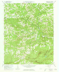
1964 Map of Hanging Rock
USGS Topo · Published 1973About this map
Hanging Rock State Park anchors the southeastern landscape of this mid-century survey, a region defined by the dramatic quartzite ridges of the Sauratown Mountain range. The topography is deeply carved by the Dan River, which snakes through the center of the sheet, and numerous tributaries like Big Creek and Peters Creek. The map documents a rural community connected by small country churches and family burial grounds, such as Simmons Chapel and the Nunn Cem.
Find a feature on this map
70 named features on this map. Tap any name to fly to it.
Don’t see what you’re looking for? This feature index may not catch every label — zoom into the map to look around manually.
Map Details
Editions of this 1964 Hanging Rock Map
4 editions found
Other maps of this area

1926 · Critz
USGS Topo · 1:48,000

1928 · Stuart
USGS Topo · 1:48,000

1928 · Critz
USGS Topo · 1:62,500

1931 · Stuart
USGS Topo · 1:62,500

1953 · Winston-Salem
USGS Topo · 1:250,000

1955 · Winston-Salem
USGS Topo · 1:250,000

1962 · Winston-Salem
USGS Topo · 1:250,000

1964 · Hanging Rock
USGS Topo · 1:24,000

1964 · Pinnacle
USGS Topo · 1:24,000

1964 · King
USGS Topo · 1:24,000