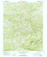
1964 Map of Hanging Rock
USGS Topo · Published 1992About this map
Hanging Rock State Park anchors the southeastern portion of this terrain, where steep ridges and deep gaps define the landscape near the Sauratown Mountain range. The topography is marked by significant vertical relief, including Moores Knob, Cooks Wall, and the dramatic Devils Chimney. The drainage pattern is dominated by the Dan River, which snakes through the eastern half of the quadrangle, joined by tributaries such as Peters Creek and Big Creek.
Find a feature on this map
68 named features on this map. Tap any name to fly to it.
Don’t see what you’re looking for? This feature index may not catch every label — zoom into the map to look around manually.
Map Details
Editions of this 1964 Hanging Rock Map
4 editions found
Other maps of this area

1926 · Critz
USGS Topo · 1:48,000

1928 · Stuart
USGS Topo · 1:48,000

1928 · Critz
USGS Topo · 1:62,500

1931 · Stuart
USGS Topo · 1:62,500

1953 · Winston-Salem
USGS Topo · 1:250,000

1955 · Winston-Salem
USGS Topo · 1:250,000

1962 · Winston-Salem
USGS Topo · 1:250,000

1964 · Hanging Rock
USGS Topo · 1:24,000

1964 · Pinnacle
USGS Topo · 1:24,000

1964 · King
USGS Topo · 1:24,000