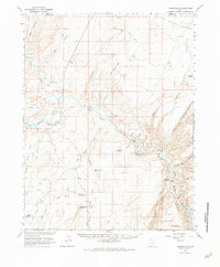
1963 Map of Hanksville
USGS Topo · Published 1981About this map
Hanksville serves as the central hub of this arid landscape, situated at the confluence where the Fremont River and Muddy Creek join to form the Dirty Devil River. The map illustrates a mid-century aviation and communication footprint, featuring the South Hanksville Airport, the Hanksville Landing Field, and a prominent Radio Facility. To the east, the terrain transitions into the San Rafael Desert and the labyrinthine Robbers Roost Canyon, areas historically defined by their isolation.
Find a feature on this map
54 named features on this map. Tap any name to fly to it.
Don’t see what you’re looking for? This feature index may not catch every label — zoom into the map to look around manually.
Map Details
Editions of this 1963 Hanksville Map
3 editions found
Other maps of this area

1885 · San Rafael
USGS Topo · 1:250,000

1952 · Mt. Ellen 4 NW
USGS Topo · 1:24,000

1952 · Bull Mountain
USGS Topo · 1:62,500

1952 · Wild Horse
USGS Topo · 1:62,500

1953 · Orange Cliffs 3 NW
USGS Topo · 1:24,000

1953 · Temple Mtn
USGS Topo · 1:62,500

1953 · Fiddler Butte
USGS Topo · 1:62,500

1954 · Stinking Springs Creek 4 SW
USGS Topo · 1:24,000

1954 · Stinking Spring Creek 3 SE
USGS Topo · 1:24,000

1954 · Stinking Spring Creek 4 SE
USGS Topo · 1:24,000