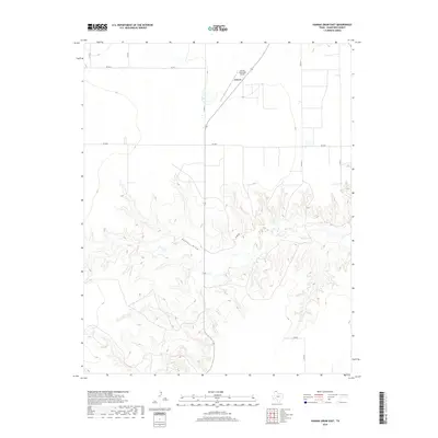
2019 Map of Hannas Draw East
USGS Topo · Published 2019About this map
The high plains of the Texas Panhandle meet the intricate drainage systems of Hannas Draw in this contemporary record of Hansford County. The city of Gruver serves as the primary hub for this agricultural region, situated at the intersection of a grid-based road network including Co Rd 11 and Fm 2018. The landscape transitions sharply from the flat, cultivated fields surrounding Gruver Municipal Airport to the deeply etched topography of the draw, where winding routes like Jones Rd navigate the broken terrain. This survey illustrates the persistent importance of ranching and farming infrastructure in the modern era, showing how historical property lines and local thoroughfares like Co Rd S and Co Rd 13 continue to define the spatial organization of the northern Panhandle.
Find a feature on this map
12 named features on this map. Tap any name to fly to it.
Don’t see what you’re looking for? This feature index may not catch every label — zoom into the map to look around manually.
Map Details
Editions of this 2019 Hannas Draw East Map
This is the sole edition of this map. No revisions or reprints were ever made.
Other maps of this area

1954 · Perryton
USGS Topo · 1:250,000

1958 · Perryton
USGS Topo · 1:250,000

1962 · Kimball
USGS Topo · 1:24,000

1962 · Hansford
USGS Topo · 1:24,000

1973 · Gruver
USGS Topo · 1:24,000

1974 · Morse
USGS Topo · 1:24,000

1974 · Hannas Draw East
USGS Topo · 1:24,000
1974 · Capps Switch SE
USGS Topo · 1:24,000

1974 · Sunray 1 SE
USGS Topo · 1:24,000

1974 · Hannas Draw West
USGS Topo · 1:24,000