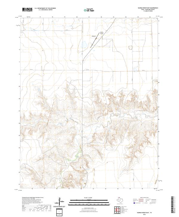
2022 Map of Hannas Draw East
USGS Topo · Published 2022About this map
Gruver occupies the northern plains of Hansford County, serving as a focal point for the surrounding agricultural and ranching landscape. The terrain transitions from the flat, cultivated uplands in the north to the intricate drainage systems of Hannas Draw in the south, where the topography becomes notably more complex with numerous small ridges and valleys. Transport and logistics are anchored by the Gruver Municipal Airport and a grid of rural routes including Fm 2018 and Co Rd S, which facilitate movement across this portion of the Texas Panhandle. The map captures the intersection of established settlement and the natural hydrology of the draw, reflecting the spatial organization of a community deeply tied to its geography.
Find a feature on this map
12 named features on this map. Tap any name to fly to it.
Don’t see what you’re looking for? This feature index may not catch every label — zoom into the map to look around manually.
Map Details
Editions of this 2022 Hannas Draw East Map
This is the sole edition of this map. No revisions or reprints were ever made.
Other maps of this area

1954 · Perryton
USGS Topo · 1:250,000

1958 · Perryton
USGS Topo · 1:250,000

1962 · Kimball
USGS Topo · 1:24,000

1962 · Hansford
USGS Topo · 1:24,000

1973 · Gruver
USGS Topo · 1:24,000

1974 · Morse
USGS Topo · 1:24,000

1974 · Hannas Draw East
USGS Topo · 1:24,000
1974 · Capps Switch SE
USGS Topo · 1:24,000

1974 · Sunray 1 SE
USGS Topo · 1:24,000

1974 · Hannas Draw West
USGS Topo · 1:24,000