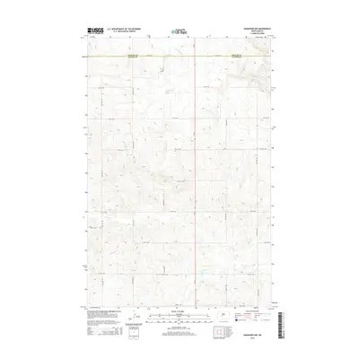
2014 Map of Hannover NW
USGS Topo · Published 2014About this map
The county line between Mercer Co and Oliver Co defines the northern reaches of this rural landscape, capturing the transition of the Great Plains in the early 21st century. The terrain is characterized by a network of drainage systems, including the southward-flowing Kinneman Cr, Brady Cr, and Square Butte Cr. These waterways carve distinct paths through the high plains, illustrating the natural drainage patterns that have shaped North Dakota's agricultural and ranching history. A rigid grid of section-line roads, such as 15th St SW and 46th Ave SW, provides the primary infrastructure for the sparsely populated region. This survey reflects the enduring Jeffersonian grid system, where transportation remains tied strictly to the survey lines of the original homesteaders, even as modern topographic mapping techniques refine our understanding of the elevation and hydrology.
Find a feature on this map
18 named features on this map. Tap any name to fly to it.
Don’t see what you’re looking for? This feature index may not catch every label — zoom into the map to look around manually.
Map Details
Editions of this 2014 Hannover NW Map
This is the sole edition of this map. No revisions or reprints were ever made.
Other maps of this area

1948 · Stanton
USGS Topo · 1:62,500

1949 · Stanton
USGS Topo · 1:62,500

1954 · McClusky
USGS Topo · 1:250,000

1958 · McClusky
USGS Topo · 1:250,000

1967 · Stanton SE
USGS Topo · 1:24,000

1968 · Hannover NE
USGS Topo · 1:24,000

1968 · Red Butte
USGS Topo · 1:24,000

1968 · Stanton
USGS Topo · 1:24,000

1968 · Hannover NW
USGS Topo · 1:24,000

1968 · Hazen East
USGS Topo · 1:24,000