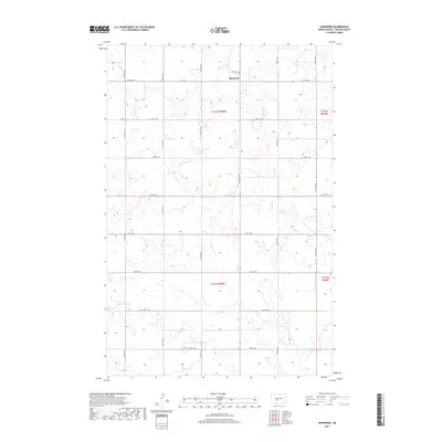
2017 Map of Hannover
USGS Topo · Published 2017About this map
Hannover serves as the central point of this Oliver County survey, established on a high plateau between significant drainage systems. The small settlement is anchored by the Hannover Cem, situated just north of the village center along Hannover Rd. The landscape is defined by the headwaters and winding paths of Square Butte Cr to the north and Hagel Cr to the east. This area of North Dakota is characterized by its rigorous grid of section lines and gravel roads, including 21st St SW and 44th Ave SW, which facilitate transport across the rural townships of t142n r85w and t141n r85w. The map illustrates the persistent agricultural patterns of the region, where roads follow the high ground to avoid the numerous small coulees and draws that feed the local creek systems.
Find a feature on this map
23 named features on this map. Tap any name to fly to it.
Don’t see what you’re looking for? This feature index may not catch every label — zoom into the map to look around manually.
Map Details
Editions of this 2017 Hannover Map
This is the sole edition of this map. No revisions or reprints were ever made.
Other maps of this area

1954 · Bismarck
USGS Topo · 1:250,000

1954 · McClusky
USGS Topo · 1:250,000

1958 · Bismarck
USGS Topo · 1:250,000

1958 · McClusky
USGS Topo · 1:250,000

1968 · Hannover NE
USGS Topo · 1:24,000

1968 · Red Butte
USGS Topo · 1:24,000

1968 · Hannover NW
USGS Topo · 1:24,000

1970 · Bluegrass
USGS Topo · 1:24,000

1970 · New Salem NW
USGS Topo · 1:24,000

1970 · New Salem NE
USGS Topo · 1:24,000