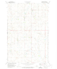
1972 Map of Hannover
USGS Topo · Published 1975About this map
The small settlement of Hannover is the primary community on this central Oliver County landscape, surveyed in the early 1970s. The terrain is defined by its drainages and isolated landmarks, most notably Square Butte and the winding course of Square Butte Creek. A secondary drainage, Hugel Creek, cuts through the eastern portion of the quadrangle, reflecting a rural landscape primarily shaped by grazing and agriculture. Industrial activity is sparsely represented by a single Mine and a Gravel Pit, alongside a prominent Pipeline corridor that traverses the prairie. The map provides a clear look at the township grid and section lines that structured settlement in this part of North Dakota before modern development altered the local road network and rural infrastructure.
Find a feature on this map
8 named features on this map. Tap any name to fly to it.
Don’t see what you’re looking for? This feature index may not catch every label — zoom into the map to look around manually.
Map Details
Editions of this 1972 Hannover Map
This is the sole edition of this map. No revisions or reprints were ever made.
Other maps of this area

1954 · Bismarck
USGS Topo · 1:250,000

1954 · McClusky
USGS Topo · 1:250,000

1958 · Bismarck
USGS Topo · 1:250,000

1958 · McClusky
USGS Topo · 1:250,000

1968 · Hannover NE
USGS Topo · 1:24,000

1968 · Red Butte
USGS Topo · 1:24,000

1968 · Hannover NW
USGS Topo · 1:24,000

1970 · Bluegrass
USGS Topo · 1:24,000

1970 · New Salem NW
USGS Topo · 1:24,000

1970 · New Salem NE
USGS Topo · 1:24,000