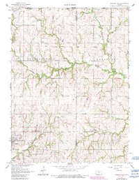
1966 Map of Hanover East
USGS Topo · Published 1983About this map
The Old Indian Treaty Boundary slices diagonally across this Kansas landscape, a legacy of 19th-century land divisions that predates the modern county lines of Washington and Marshall. At the intersection of rail and river, the town of Hanover serves as the local anchor, featuring Veterans Memorial Park and the Hanover Cem. The transportation history of the region is etched into the terrain, visible in the active Union Pacific line and an abandoned Old Railroad Grade that winds toward Bremen.
Find a feature on this map
25 named features on this map. Tap any name to fly to it.
Don’t see what you’re looking for? This feature index may not catch every label — zoom into the map to look around manually.
Map Details
Editions of this 1966 Hanover East Map
2 editions found
Other maps of this area

1889 · Marysville
USGS Topo · 1:125,000

1894 · Marysville
USGS Topo · 1:125,000

1955 · Manhattan
USGS Topo · 1:250,000

1955 · Lincoln
USGS Topo · 1:250,000

1956 · Manhattan
USGS Topo · 1:250,000

1957 · Manhattan
USGS Topo · 1:250,000

1957 · Lincoln
USGS Topo · 1:250,000

1958 · Lincoln
USGS Topo · 1:250,000

1966 · Marysville
USGS Topo · 1:24,000

1966 · Hanover SE
USGS Topo · 1:24,000