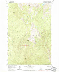
1963 Map of Hanover Mtn.
USGS Topo · Published 1986About this map
Nez Perce National Forest dominates this topographic study, revealing a high-elevation landscape defined by the drainage networks of the Wind River and Slate Creek. The map documents a primitive transportation network consisting almost entirely of trails and jeep tracks, such as the Jeep Trail winding through the Florence Basin at the western edge of the quadrangle. Significant for researchers of backcountry history, the survey identifies several isolated structures including Moores Station and the Hanover Mtn Cabin near the summit of Hanover Mtn. The terrain is punctuated by alpine features like Gospel Peak and Umbrella Butte, while numerous small lakes including Indigo Lake and Emerald Lake sit within deep cirques. This documentation captures the area after its early mining heyday but before modern recreational development, preserving the placement of family-named landmarks like Marten Hill and the meadows at Round Bottom Meadows.
Find a feature on this map
37 named features on this map. Tap any name to fly to it.
Don’t see what you’re looking for? This feature index may not catch every label — zoom into the map to look around manually.
Map Details
Editions of this 1963 Hanover Mtn. Map
3 editions found

Other maps of this area

1931 · Buffalo Hump
USGS Topo · 1:125,000

1934 · Buffalo Hump
USGS Topo · 1:125,000

1938 · Riggins
USGS Topo · 1:96,000

1945 · Riggins
USGS Topo · 1:125,000

1955 · Grangeville
USGS Topo · 1:250,000

1956 · Burgdorf
USGS Topo · 1:62,500

1956 · Elk City
USGS Topo · 1:250,000

1959 · Grangeville
USGS Topo · 1:250,000

1960 · Elk City
USGS Topo · 1:250,000

1963 · Sourdough Peak
USGS Topo · 1:24,000