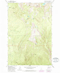
1963 Map of Hanover Mtn.
USGS Topo · Published 1987About this map
Nez Perce National Forest dominates this high-elevation Idaho landscape, where the headwaters of numerous drainages begin their descent toward the Salmon River. The map center is marked by Hanover Mtn and the adjacent Indigo Lake, situated within the expansive Gospel Hump Wilderness. This 1963 survey, with revisions from 1984, shows a territory defined by peaks and high meadows rather than human settlements, with the exception of the Moores Work Center located on the eastern edge. Narrow jeep trails provide the primary access through the drainage basins of Slate Creek and Meadow Creek. Peaks such as Gospel Peak and Umbrella Butte serve as primary landmarks for navigating the complex ridgelines and glacial cirques that hold high-altitude water bodies like Emerald Lake and Upper Slate Lake.
Find a feature on this map
36 named features on this map. Tap any name to fly to it.
Don’t see what you’re looking for? This feature index may not catch every label — zoom into the map to look around manually.
Map Details
Editions of this 1963 Hanover Mtn. Map
3 editions found

Other maps of this area

1931 · Buffalo Hump
USGS Topo · 1:125,000

1934 · Buffalo Hump
USGS Topo · 1:125,000

1938 · Riggins
USGS Topo · 1:96,000

1945 · Riggins
USGS Topo · 1:125,000

1955 · Grangeville
USGS Topo · 1:250,000

1956 · Burgdorf
USGS Topo · 1:62,500

1956 · Elk City
USGS Topo · 1:250,000

1959 · Grangeville
USGS Topo · 1:250,000

1960 · Elk City
USGS Topo · 1:250,000

1963 · Sourdough Peak
USGS Topo · 1:24,000