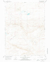
1960 Map of Hansen Lake
USGS Topo · Published 1978About this map
Battle Spring Flat and the expansive Chain Lakes Flat dominate this high desert landscape, characterized by an intricate system of ephemeral and permanent basins. Grounded in the central basin, Hansen Lake and McCann Lake are part of the larger Chain Lakes network, situated just north of the prominent Chain Lakes Rim. This elevated escarpment provides a distinct topographic boundary, separating the lake flats from the dissected drainage of the East Fork Sourdough Gulch. The presence of Coal Butte and several identified mine sites and wells suggests an era of focused resource extraction and land management within the Missouri River Basin development program. The Wamsutter-Crooks Gap Road serves as the primary corridor through this isolated Sweetwater County terrain, linking remote water sources like Circle Bar Lake to the broader regional network during the late 1950s.
Find a feature on this map
13 named features on this map. Tap any name to fly to it.
Don’t see what you’re looking for? This feature index may not catch every label — zoom into the map to look around manually.
Map Details
Editions of this 1960 Hansen Lake Map
3 editions found

Other maps of this area

1954 · Rawlins
USGS Topo · 1:250,000

1954 · Rock Springs
USGS Topo · 1:250,000

1955 · Lander
USGS Topo · 1:250,000

1955 · Casper
USGS Topo · 1:250,000

1958 · Rawlins
USGS Topo · 1:250,000

1958 · Casper
USGS Topo · 1:250,000

1958 · Lander
USGS Topo · 1:250,000

1958 · Rock Springs
USGS Topo · 1:250,000

1960 · Battle Spring
USGS Topo · 1:24,000

1960 · Hansen Lake NE
USGS Topo · 1:24,000