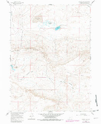
1960 Map of Hansen Lake
USGS Topo · Published 1981About this map
Chain Lakes Flat and the surrounding high desert terrain dominate this 1960 survey, offering a look at the hydrography and industrial footprints of Sweetwater County before modern expansion. The landscape is defined by the massive Chain Lakes Rim, which separates the northern flats from the complex drainage of Sourdough Gulch and the East Fork Sourdough Gulch to the south. Small water bodies like Hansen Lake, Circle Bar Lake, and McCann Lake are scattered across the alkali flats, providing critical orientation points in a region of shifting dunes and seasonal basins.
Find a feature on this map
23 named features on this map. Tap any name to fly to it.
Don’t see what you’re looking for? This feature index may not catch every label — zoom into the map to look around manually.
Map Details
Editions of this 1960 Hansen Lake Map
3 editions found

Other maps of this area

1954 · Rawlins
USGS Topo · 1:250,000

1954 · Rock Springs
USGS Topo · 1:250,000

1955 · Lander
USGS Topo · 1:250,000

1955 · Casper
USGS Topo · 1:250,000

1958 · Rawlins
USGS Topo · 1:250,000

1958 · Casper
USGS Topo · 1:250,000

1958 · Lander
USGS Topo · 1:250,000

1958 · Rock Springs
USGS Topo · 1:250,000

1960 · Battle Spring
USGS Topo · 1:24,000

1960 · Hansen Lake NE
USGS Topo · 1:24,000