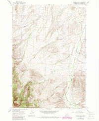
1965 Map of Hansen Ranch
USGS Topo · Published 1989About this map
Hansen Ranch sits as the primary human landmark in this corner of Beaverhead County, surrounded by a complex network of high-elevation drainages and early water management systems. The map illustrates a landscape shaped by ranching and irrigation, evidenced by the Paiment Ditch and other unnamed Ditch segments that divert water through the valley floor. These human-made waterways run parallel to the natural flow of Medicine Lodge Creek and its tributaries, including Barrett Creek and Poole Creek.
Find a feature on this map
17 named features on this map. Tap any name to fly to it.
Don’t see what you’re looking for? This feature index may not catch every label — zoom into the map to look around manually.
Map Details
Editions of this 1965 Hansen Ranch Map
3 editions found
Other maps of this area

1893 · Dillon
USGS Topo · 1:250,000

1952 · Eli Spring
USGS Topo · 1:24,000

1955 · Dubois
USGS Topo · 1:250,000

1955 · Dillon
USGS Topo · 1:250,000

1957 · Dillon
USGS Topo · 1:250,000

1958 · Dubois
USGS Topo · 1:250,000

1958 · Dillon
USGS Topo · 1:250,000

1959 · Grant
USGS Topo · 1:62,500

1962 · Dillon
USGS Topo · 1:250,000
1965 · Garfield Canyon
USGS Topo · 1:24,000