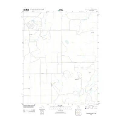
2012 Map of Hansford Camp
USGS Topo · Published 2012About this map
Hansford Camp and the industrial infrastructure of the Oklahoma-Texas borderlands define this landscape in the early 21st century. The map illustrates a region where energy extraction and rural life intersect, primarily through the extensive Hitchland Gas and Oil Field and the Spearman North Gas and Oil Field. These sites, marked by complex road networks and industrial clusters, sit alongside traditional landmarks such as the New Hope Cem and high points like Mt Helland and Lightning Point. The drainage patterns of Hackberry Cr and Palo Duro Cr reveal the natural topography of the High Plains, providing a contrast to the geometric precision of the county road system, including Co Road F and Co Road G. This map captures a specific moment in the continuing development of the midcontinent oil and gas industry within a deeply rural setting.
Find a feature on this map
15 named features on this map. Tap any name to fly to it.
Don’t see what you’re looking for? This feature index may not catch every label — zoom into the map to look around manually.
Map Details
Editions of this 2012 Hansford Camp Map
This is the sole edition of this map. No revisions or reprints were ever made.
Other maps of this area

1954 · Perryton
USGS Topo · 1:250,000

1958 · Perryton
USGS Topo · 1:250,000

1962 · Kimball
USGS Topo · 1:24,000

1962 · Hansford Camp
USGS Topo · 1:24,000

1962 · Waka SW
USGS Topo · 1:24,000

1968 · Hardesty
USGS Topo · 1:24,000

1968 · Hardesty SE
USGS Topo · 1:24,000

1968 · Guymon SE
USGS Topo · 1:24,000

1973 · Horseshoe Hill
USGS Topo · 1:24,000

1973 · Waka
USGS Topo · 1:24,000