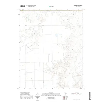
2019 Map of Hansford Camp
USGS Topo · Published 2019About this map
Hansford Camp and the surrounding high plains of the Oklahoma Panhandle are defined by the deep drainage of Hackberry Cr and its associated breaks. This 2019 survey captures the quiet rural character of Texas County, where the landscape transitions from flat agricultural plateaus into the more varied topography of Lightning Point and Mt Helland. A sparse network of county and state roads, including Farm Rd 1261 and Farm Rd 3214, provides the primary access to these isolated sections. The presence of New Hope Cem on the eastern side of the quadrangle offers a specific point of interest for genealogists and local historians, anchoring the contemporary landscape to the area's earlier settlement history. The map's detailed contours reveal the intricate erosion patterns typical of the region's northern stream systems near the Hansford Co boundary.
Find a feature on this map
12 named features on this map. Tap any name to fly to it.
Don’t see what you’re looking for? This feature index may not catch every label — zoom into the map to look around manually.
Map Details
Editions of this 2019 Hansford Camp Map
This is the sole edition of this map. No revisions or reprints were ever made.
Other maps of this area

1954 · Perryton
USGS Topo · 1:250,000

1958 · Perryton
USGS Topo · 1:250,000

1962 · Kimball
USGS Topo · 1:24,000

1962 · Hansford Camp
USGS Topo · 1:24,000

1962 · Waka SW
USGS Topo · 1:24,000

1968 · Hardesty
USGS Topo · 1:24,000

1968 · Hardesty SE
USGS Topo · 1:24,000

1968 · Guymon SE
USGS Topo · 1:24,000

1973 · Horseshoe Hill
USGS Topo · 1:24,000

1973 · Waka
USGS Topo · 1:24,000