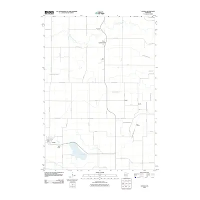
2010 Map of Hanska
USGS Topo · Published 2010About this map
The Little Cottonwood River meanders across this rural Brown County landscape, defining the topography north of Searles. This 2010 survey documents the enduring agricultural structure of the region, where small settlements like Linden and Hanska serve as local hubs. The map reveals a complex network of managed waterways, including Judicial Ditch Number Ten and County Ditch Number Sixtythree, which are essential for the drainage of former wetlands like Dane Lakebed. Genealogists and local historians will find several burial grounds noted, such as Mount Pisgah Cemetery near the shores of Linden Lake, Saint Johns Cemetery, and Rice Lake Cemetery. The layout of the land is further defined by a grid of rural routes like County Hwy-24 and 150th St, reflecting the persistent township-and-range surveying system that shaped this part of Minnesota.
Find a feature on this map
31 named features on this map. Tap any name to fly to it.
Don’t see what you’re looking for? This feature index may not catch every label — zoom into the map to look around manually.
Map Details
Editions of this 2010 Hanska Map
This is the sole edition of this map. No revisions or reprints were ever made.
Other maps of this area

1953 · New Ulm
USGS Topo · 1:250,000

1957 · New Ulm
USGS Topo · 1:250,000

1958 · New Ulm
USGS Topo · 1:250,000

1964 · New Ulm
USGS Topo · 1:24,000

1964 · Courtland
USGS Topo · 1:24,000

1964 · Essig
USGS Topo · 1:24,000

1965 · Madelia
USGS Topo · 1:24,000

1965 · Hanska
USGS Topo · 1:24,000

1965 · Perth
USGS Topo · 1:24,000

1965 · Cambria
USGS Topo · 1:24,000