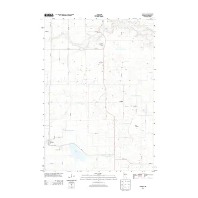
2013 Map of Hanska
USGS Topo · Published 2013About this map
Hanska sits at the southwestern edge of this survey, anchored by MN-257 and the community post office. The landscape is a complex network of agricultural drainage, including the Little Cottonwood River and numerous engineered waterways such as Judicial Ditch Number Ten and County Ditch Number Sixtythree. These systems trace the historical modification of the terrain for farming, illustrated clearly by the presence of Dane Lakebed and the surrounding basins. Near the northern border, the settlement of Searles serves as a local hub along MN-15. Throughout the rural townships, local genealogy is preserved at sites like Mt Pisgah Cem, Saint Johns Cem, and Rice Lake Cem, which are scattered among the section lines and along the edges of Linden Lake. The terrain is generally level, with the prominent exception of Mt Pisgah rising near the southern boundary.
Find a feature on this map
43 named features on this map. Tap any name to fly to it.
Don’t see what you’re looking for? This feature index may not catch every label — zoom into the map to look around manually.
Map Details
Editions of this 2013 Hanska Map
This is the sole edition of this map. No revisions or reprints were ever made.
Other maps of this area

1953 · New Ulm
USGS Topo · 1:250,000

1957 · New Ulm
USGS Topo · 1:250,000

1958 · New Ulm
USGS Topo · 1:250,000

1964 · New Ulm
USGS Topo · 1:24,000

1964 · Courtland
USGS Topo · 1:24,000

1964 · Essig
USGS Topo · 1:24,000

1965 · Madelia
USGS Topo · 1:24,000

1965 · Hanska
USGS Topo · 1:24,000

1965 · Perth
USGS Topo · 1:24,000

1965 · Cambria
USGS Topo · 1:24,000