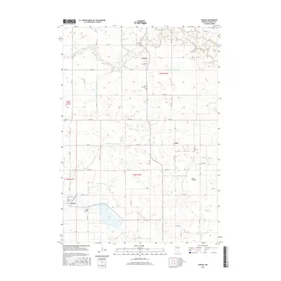
2016 Map of Hanska
USGS Topo · Published 2016About this map
Hanska sits at the southwestern edge of this Brown County landscape, its grid defined by Railroad Ave and early twentieth-century street layouts. The surrounding prairie is defined by an extensive network of water management, featuring numerous named drainage projects such as County Ditch Number Fiftyeight, Judicial Ditch Number Ten, and County Ditch Number Two. These modifications reflect the agricultural transformation of the region, where even former water bodies like Dane Lakebed have been integrated into the farming landscape.
Find a feature on this map
43 named features on this map. Tap any name to fly to it.
Don’t see what you’re looking for? This feature index may not catch every label — zoom into the map to look around manually.
Map Details
Editions of this 2016 Hanska Map
This is the sole edition of this map. No revisions or reprints were ever made.
Other maps of this area

1953 · New Ulm
USGS Topo · 1:250,000

1957 · New Ulm
USGS Topo · 1:250,000

1958 · New Ulm
USGS Topo · 1:250,000

1964 · New Ulm
USGS Topo · 1:24,000

1964 · Courtland
USGS Topo · 1:24,000

1964 · Essig
USGS Topo · 1:24,000

1965 · Madelia
USGS Topo · 1:24,000

1965 · Hanska
USGS Topo · 1:24,000

1965 · Perth
USGS Topo · 1:24,000

1965 · Cambria
USGS Topo · 1:24,000