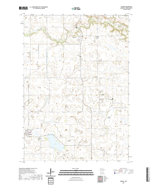
2022 Map of Hanska
USGS Topo · Published 2022About this map
Linden Lake and the nearby Dane Lakebed anchor the southern portion of this Brown County landscape, revealing a region defined by extensive hydrological management. The intricate network of drainage systems, including Judicial Ditch Number Nine and County Ditch Number Sixtythree, illustrates the historical transformation of Minnesota's prairie wetlands into productive agricultural territory. The town of Hanska sits near the southwestern corner, while the small settlements of Searles and Linden serve as local hubs connected by a grid of county highways.
Find a feature on this map
44 named features on this map. Tap any name to fly to it.
Don’t see what you’re looking for? This feature index may not catch every label — zoom into the map to look around manually.
Map Details
Editions of this 2022 Hanska Map
This is the sole edition of this map. No revisions or reprints were ever made.
Other maps of this area

1953 · New Ulm
USGS Topo · 1:250,000

1957 · New Ulm
USGS Topo · 1:250,000

1958 · New Ulm
USGS Topo · 1:250,000

1964 · New Ulm
USGS Topo · 1:24,000

1964 · Courtland
USGS Topo · 1:24,000

1964 · Essig
USGS Topo · 1:24,000

1965 · Madelia
USGS Topo · 1:24,000

1965 · Hanska
USGS Topo · 1:24,000

1965 · Perth
USGS Topo · 1:24,000

1965 · Cambria
USGS Topo · 1:24,000