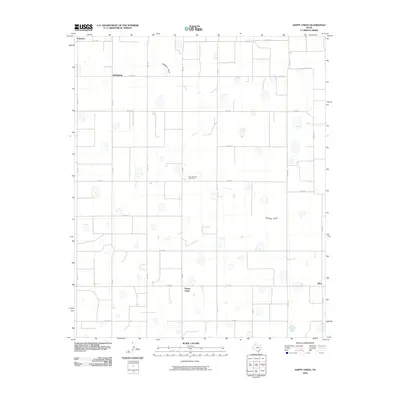
2010 Map of Happy Union
USGS Topo · Published 2010About this map
Happy Union anchors this portion of the Texas Panhandle, where the landscape is defined by the rigid geometry of the agricultural grid and the sparse presence of irrigation depressions. This 2010 survey illustrates the region's enduring dependence on industrial farming infrastructure, most notably the Four Hundred Cotton Gin located north of the primary settlement. The terrain is largely flat, bisected by the intermittent course of Callahan Draw which winds across the northern and eastern sections. Other small agricultural clusters and named locales such as Snyder, Ellen, and Furguson are scattered throughout the quadrangle, connected by an extensive network of farm-to-market roads and county lines. These coordinates, including FM 400, FM 784, and FM 1914, facilitate the transport of crops in this high-plains environment where the cotton industry remains a central fixture of the local economy.
Find a feature on this map
27 named features on this map. Tap any name to fly to it.
Don’t see what you’re looking for? This feature index may not catch every label — zoom into the map to look around manually.
Map Details
Editions of this 2010 Happy Union Map
This is the sole edition of this map. No revisions or reprints were ever made.
Other maps of this area

1954 · Lubbock
USGS Topo · 1:250,000

1954 · Plainview
USGS Topo · 1:250,000

1957 · Abernathy
USGS Topo · 1:62,500

1958 · Plainview
USGS Topo · 1:250,000

1965 · Wasson
USGS Topo · 1:24,000

1965 · Plainview
USGS Topo · 1:24,000

1968 · Happy Union
USGS Topo · 1:24,000

1968 · Barwise
USGS Topo · 1:24,000

1968 · Plainview SE
USGS Topo · 1:24,000

1968 · Julia Lake
USGS Topo · 1:24,000