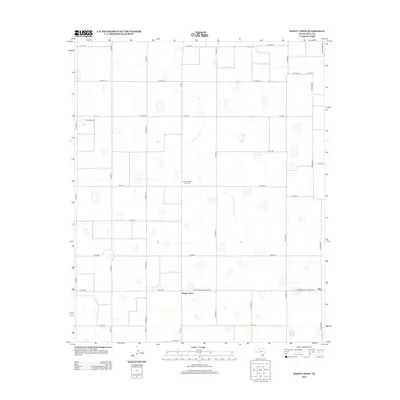
2012 Map of Happy Union
USGS Topo · Published 2012About this map
Happy Union sits at the heart of this agricultural landscape in Hale County, where the geometric precision of the High Plains is evident in the vast grid of county roads. The importance of the regional cotton economy is signaled by the Four Hundred Cotton Gin, a specific industrial landmark situated among the farm sections. This 2012 survey illustrates a modern rural infrastructure defined by state-maintained corridors like Farm-to-Market Road 784 and Fm-1914. The small community of Ellen appears on the eastern edge of the quadrangle, connected to the surrounding acreage by a dense network of local routes including Co Road BB and Ranch Road 789. Aviation infrastructure is represented by True Airport in the northwest, serving as a localized hub within this predominantly agrarian environment.
Find a feature on this map
30 named features on this map. Tap any name to fly to it.
Don’t see what you’re looking for? This feature index may not catch every label — zoom into the map to look around manually.
Map Details
Editions of this 2012 Happy Union Map
This is the sole edition of this map. No revisions or reprints were ever made.
Other maps of this area

1954 · Lubbock
USGS Topo · 1:250,000

1954 · Plainview
USGS Topo · 1:250,000

1957 · Abernathy
USGS Topo · 1:62,500

1958 · Plainview
USGS Topo · 1:250,000

1965 · Wasson
USGS Topo · 1:24,000

1965 · Plainview
USGS Topo · 1:24,000

1968 · Happy Union
USGS Topo · 1:24,000

1968 · Barwise
USGS Topo · 1:24,000

1968 · Plainview SE
USGS Topo · 1:24,000

1968 · Julia Lake
USGS Topo · 1:24,000