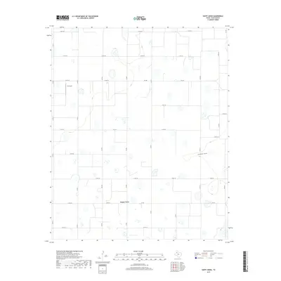
2019 Map of Happy Union
USGS Topo · Published 2019About this map
Happy Union sits at the center of this agricultural landscape in Hale County, where the High Plains terrain is etched by the meandering path of Callahan Draw. In 2019, the region is defined by a rigorous grid of county roads and several farm-to-market routes, including Fm 400, Fm 784, and Fm 1914, which serve the surrounding farming community. The map reveals the specialized infrastructure of rural Texas, notably the True Airport located in the northwest corner near Co RD 155. Small depression ponds and wetlands dot the landscape between the surveyed fields, illustrating the subtle hydrology that characterizes the Llano Estacado. This document provides a clear view of the modern rural road network and drainage patterns in a quiet corner of the Panhandle.
Find a feature on this map
26 named features on this map. Tap any name to fly to it.
Don’t see what you’re looking for? This feature index may not catch every label — zoom into the map to look around manually.
Map Details
Editions of this 2019 Happy Union Map
This is the sole edition of this map. No revisions or reprints were ever made.
Other maps of this area

1954 · Lubbock
USGS Topo · 1:250,000

1954 · Plainview
USGS Topo · 1:250,000

1957 · Abernathy
USGS Topo · 1:62,500

1958 · Plainview
USGS Topo · 1:250,000

1965 · Wasson
USGS Topo · 1:24,000

1965 · Plainview
USGS Topo · 1:24,000

1968 · Happy Union
USGS Topo · 1:24,000

1968 · Barwise
USGS Topo · 1:24,000

1968 · Plainview SE
USGS Topo · 1:24,000

1968 · Julia Lake
USGS Topo · 1:24,000