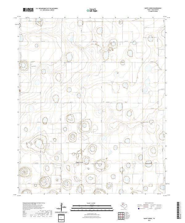
2022 Map of Happy Union
USGS Topo · Published 2022About this map
Happy Union sits at the center of this rural Hale County landscape, where the agricultural grid of the Texas Panhandle is occasionally interrupted by the winding path of Callahan Draw. This contemporary survey reveals a high density of depression wetlands and playa lakes characteristic of the Llano Estacado, appearing as small, isolated basins scattered across the plains. The region’s transport network is defined by a rigid system of section-line roads, including Way Rd and numerous county routes such as Co Rd 195 and Co Rd 215. Infrastructure for local aviation is represented by True Airport, while a series of Farm to Market roads like Fm 1914 and Fm 784 provide the primary links between the scattered farmsteads and the small settlement at Happy Union.
Find a feature on this map
26 named features on this map. Tap any name to fly to it.
Don’t see what you’re looking for? This feature index may not catch every label — zoom into the map to look around manually.
Map Details
Editions of this 2022 Happy Union Map
This is the sole edition of this map. No revisions or reprints were ever made.
Other maps of this area

1954 · Lubbock
USGS Topo · 1:250,000

1954 · Plainview
USGS Topo · 1:250,000

1957 · Abernathy
USGS Topo · 1:62,500

1958 · Plainview
USGS Topo · 1:250,000

1965 · Wasson
USGS Topo · 1:24,000

1965 · Plainview
USGS Topo · 1:24,000

1968 · Happy Union
USGS Topo · 1:24,000

1968 · Barwise
USGS Topo · 1:24,000

1968 · Plainview SE
USGS Topo · 1:24,000

1968 · Julia Lake
USGS Topo · 1:24,000