
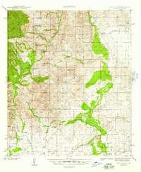
1945 Map of Happy Valley
USGS Topo · Published 1945About this map
The San Pedro River carves a critical path through this landscape, marking a transition from the Rincon Mountains to the arid expanse of Galleta Flat. During the early 1940s, the area supported a network of remote family cattle operations, including the Ada Miller Ranch, John Keith Ranch, and Pacheco Ranch. The geography is defined by significant elevations like Lechuguilla Pk and Wildhorse Mtn, while the Saguaro National Monument Boundary frames the western edge of the survey.
Find a feature on this map
48 named features on this map. Tap any name to fly to it.
Don’t see what you’re looking for? This feature index may not catch every label — zoom into the map to look around manually.
Map Details
Editions of this 1945 Happy Valley Map
2 editions found
Other maps of this area

1904 · Patagonia
USGS Topo · 1:125,000

1904 · Tucson
USGS Topo · 1:125,000

1905 · Patagonia
USGS Topo · 1:125,000

1905 · Tucson
USGS Topo · 1:125,000

1915 · Benson
USGS Topo · 1:125,000

1922 · St. David
USGS Topo · 1:62,500

1926 · Whetstone
USGS Topo · 1:62,500

1943 · Benson
USGS Topo · 1:125,000

1943 · Dragoon
USGS Topo · 1:62,500

1943 · Winchester Mts.
USGS Topo · 1:62,500