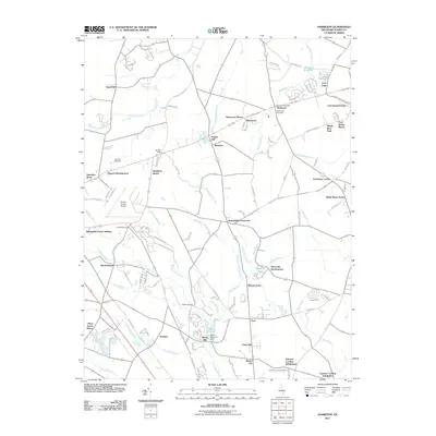
2011 Map of Harbeson
USGS Topo · Published 2011About this map
The unincorporated community of Harbeson serves as a central point in this Sussex County landscape, home to the Harbeson Post Office and the Beaverdam Cemetery. The area is defined by an intricate network of drainage ditches and branches, such as Peterkins Branch and White Oak Swamp Ditch, which support the region's agricultural character. Further south, the settlement of Stockley sits near the headwaters of the Stockley Branch, while the Morris Mill and Morris Millpond provide evidence of early local industry and water management along Cow Bridge Branch.
Find a feature on this map
126 named features on this map. Tap any name to fly to it.
Don’t see what you’re looking for? This feature index may not catch every label — zoom into the map to look around manually.
Map Details
Editions of this 2011 Harbeson Map
This is the sole edition of this map. No revisions or reprints were ever made.
Other maps of this area

1917 · Millsboro
USGS Topo · 1:62,500

1918 · Cedar Creek
USGS Topo · 1:62,500

1918 · Rehoboth
USGS Topo · 1:62,500

1918 · Cape Henlopen
USGS Topo · 1:62,500

1919 · Cedar Creek
USGS Topo · 1:62,500

1937 · Cape Henlopen
USGS Topo · 1:62,500

1938 · Cedar Creek
USGS Topo · 1:62,500

1938 · Millsboro
USGS Topo · 1:62,500

1938 · Rehoboth
USGS Topo · 1:62,500

1943 · Fairmount
USGS Topo · 1:24,000
Featured Places
- Georgetown, DE
- Harbeson, DE
- Briarwood Manor, DE
- Holly Leaf Estates Mobile Home Park, DE
- Larence Cordrey Subdivision, DE