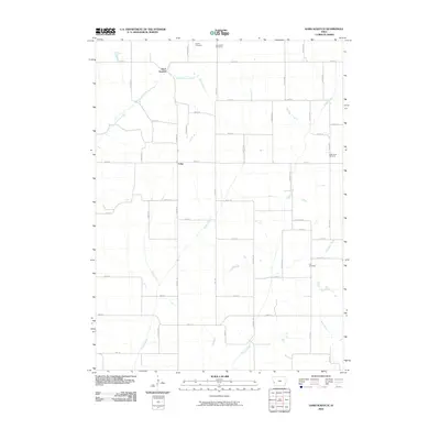
2010 Map of Hard Scratch
USGS Topo · Published 2010About this map
Hard Scratch and Crisp anchor this rural Harrison County landscape, where a series of north-south flowing creeks define the terrain. The network of waterways, including Harris Grove Creek, Potato Creek, and Pigeon Creek, dictates the placement of section-line roads and family-linked landmarks. This 2010 survey captures the agricultural layout of the region, emphasizing the longevity of local burial grounds. Genealogists and local historians can locate several historic interments including Bethel Cemetery and Henderson Cemetery in the north, while Valley View Cemetery and Cox Cemetery serve the eastern and southern portions of the quadrangle. The grid of country roads, from Reading Trl to Taylor Ave, remains the primary framework for this traditional farming community.
Find a feature on this map
48 named features on this map. Tap any name to fly to it.
Don’t see what you’re looking for? This feature index may not catch every label — zoom into the map to look around manually.
Map Details
Editions of this 2010 Hard Scratch Map
This is the sole edition of this map. No revisions or reprints were ever made.
Other maps of this area

1893 · Omaha
USGS Topo · 1:62,500

1954 · Omaha
USGS Topo · 1:250,000

1956 · Underwood
USGS Topo · 1:24,000

1956 · Neola
USGS Topo · 1:24,000

1957 · Omaha
USGS Topo · 1:250,000

1957 · Honey Creek
USGS Topo · 1:24,000

1958 · Omaha
USGS Topo · 1:250,000

1970 · Logan
USGS Topo · 1:24,000
1970 · Beebeetown
USGS Topo · 1:24,000
1978 · Hard Scratch
USGS Topo · 1:24,000