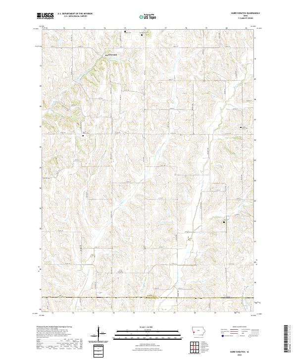
2022 Map of Hard Scratch
USGS Topo · Published 2022About this map
Hard Scratch sits at the northern edge of this agricultural landscape in Harrison County, positioned where the drainage of Harris Grove Cr meets the local road network. The terrain is defined by a dense network of creek valleys, including Potato Cr, Vore Cr, and Pigeon Cr, which dictated the placement of early cemeteries and rural routes. The distribution of sites like Harris Grove Cem and Bethel Cem reflects the scattered nature of early community life in this part of western Iowa. A grid of secondary roads and trails, such as Co RD f52 and Reading Trl, connects the various sections, while the southern boundary marks the transition into Pottawattamie Co. The map illustrates a traditional Midwestern township structure where small family and community burial grounds remain the primary landmarks of the local history.
Find a feature on this map
67 named features on this map. Tap any name to fly to it.
Don’t see what you’re looking for? This feature index may not catch every label — zoom into the map to look around manually.
Map Details
Editions of this 2022 Hard Scratch Map
This is the sole edition of this map. No revisions or reprints were ever made.
Other maps of this area

1893 · Omaha
USGS Topo · 1:62,500

1954 · Omaha
USGS Topo · 1:250,000

1956 · Underwood
USGS Topo · 1:24,000

1956 · Neola
USGS Topo · 1:24,000

1957 · Omaha
USGS Topo · 1:250,000

1957 · Honey Creek
USGS Topo · 1:24,000

1958 · Omaha
USGS Topo · 1:250,000

1970 · Logan
USGS Topo · 1:24,000
1970 · Beebeetown
USGS Topo · 1:24,000
1978 · Hard Scratch
USGS Topo · 1:24,000