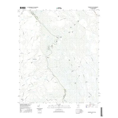
2017 Map of Hardeeville NW
USGS Topo · Published 2017About this map
The Savannah River meanders through this low-lying borderland between Jasper Co, South Carolina, and Effingham Co, Georgia. The river's historical path is traced by numerous oxbows and cutoffs like Old River, Gin Raw Lake, and Tew Lake. Settlement is concentrated on the higher ground flanking the river bottomlands, notably at Haddonville and Stillwell. For those tracing family histories, several small burial grounds are marked throughout the area, including Union Spring Cem and Pisgah Cem. The map illustrates a landscape shaped by water and timber, characterized by features like Sweet Leaf Swamp, Magnolia Ridge, and Sand Hills. Numerous family-named landmarks such as Bowl Maker Point, Zacharias Point, and Gnann Fishpond suggest a deep-rooted local history tied to the river's edge and its tributaries like Ebenezer Creek.
Find a feature on this map
91 named features on this map. Tap any name to fly to it.
Don’t see what you’re looking for? This feature index may not catch every label — zoom into the map to look around manually.
Map Details
Editions of this 2017 Hardeeville NW Map
This is the sole edition of this map. No revisions or reprints were ever made.
Other maps of this area

1919 · Pineland
USGS Topo · 1:62,500

1919 · Shirley
USGS Topo · 1:62,500

1919 · Egypt
USGS Topo · 1:62,500

1920 · Hardeeville
USGS Topo · 1:62,500

1939 · Egypt
USGS Topo · 1:62,500

1943 · Pineland
USGS Topo · 1:62,500

1943 · Hardeeville
USGS Topo · 1:62,500

1943 · Egypt
USGS Topo · 1:62,500

1943 · Shirley
USGS Topo · 1:62,500

1947 · Savannah
USGS Topo · 1:250,000