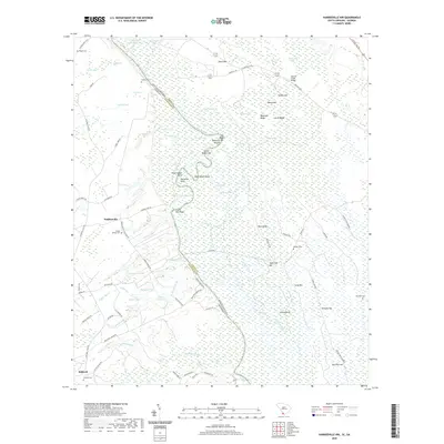
2020 Map of Hardeeville NW
USGS Topo · Published 2020About this map
The Savannah River meanders along the border of South Carolina and Georgia, creating a complex network of backwaters and riverbed landmarks such as Big Boykin Bar and Robinson Round. The landscape is defined by its transition from the low-lying Sweet Leaf Swamp to elevated features like Magnolia Ridge and Sugarloaf Hill. Human settlement is concentrated around Stillwell and Haddonville, with a clear pattern of rural development along historic routes like Old Augusta Rd and Sisters Ferry Rd E. Genealogists will find significant value in the distribution of family and community burial sites, including Strohbar Cem, Winkler Cem, and Union Spring Cem. The presence of numerous named ponds and branches, such as Gnann Fishpond and Keiffer Br, illustrates the historical reliance on local hydrology for agriculture and industry in Jasper and Effingham Counties.
Find a feature on this map
96 named features on this map. Tap any name to fly to it.
Don’t see what you’re looking for? This feature index may not catch every label — zoom into the map to look around manually.
Map Details
Editions of this 2020 Hardeeville NW Map
This is the sole edition of this map. No revisions or reprints were ever made.
Other maps of this area

1919 · Pineland
USGS Topo · 1:62,500

1919 · Shirley
USGS Topo · 1:62,500

1919 · Egypt
USGS Topo · 1:62,500

1920 · Hardeeville
USGS Topo · 1:62,500

1939 · Egypt
USGS Topo · 1:62,500

1943 · Pineland
USGS Topo · 1:62,500

1943 · Hardeeville
USGS Topo · 1:62,500

1943 · Egypt
USGS Topo · 1:62,500

1943 · Shirley
USGS Topo · 1:62,500

1947 · Savannah
USGS Topo · 1:250,000