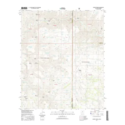
2017 Map of Harden Cienega
USGS Topo · Published 2017About this map
Sierra Aguilada and the high desert plateaus of the Gila and Apache National Forests define this borderland where Arizona and New Mexico meet. The landscape is carved by the San Francisco River and its intricate network of drainages, including Coalson Canyon and Frisco Canyon. This terrain, dominated by mesas like Antelope Mesa and Table Top Mesa, reveals a long history of water management in a demanding environment.
Find a feature on this map
123 named features on this map. Tap any name to fly to it.
Don’t see what you’re looking for? This feature index may not catch every label — zoom into the map to look around manually.
Map Details
Editions of this 2017 Harden Cienega Map
This is the sole edition of this map. No revisions or reprints were ever made.
Other maps of this area

1910 · Mogollon
USGS Topo · 1:125,000

1912 · Mogollon
USGS Topo · 1:125,000

1913 · Morenci
USGS Topo · 1:125,000

1915 · Morenci
USGS Topo · 1:125,000

1954 · Clifton
USGS Topo · 1:250,000

1957 · Clifton
USGS Topo · 1:250,000

1958 · Clifton
USGS Topo · 1:250,000

1962 · Clifton
USGS Topo · 1:250,000

1962 · Big Lue Mts
USGS Topo · 1:62,500
1965 · Mule Creek
USGS Topo · 1:24,000