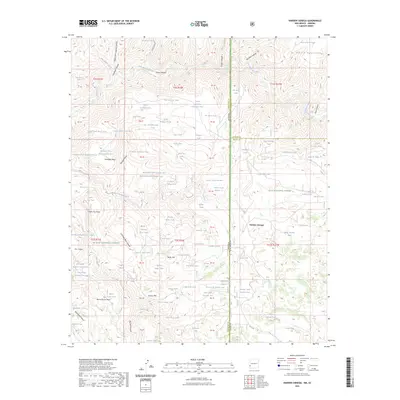
2023 Map of Harden Cienega
USGS Topo · Published 2023About this map
Harden Cienega Creek flows through this high-elevation landscape along the border of New Mexico and Arizona, where the Gila National Forest and Apache National Forest converge. This 2023 survey illustrates a complex network of water management features essential for ranching and forest management, including dozens of named stock tanks such as Red Tank, Tiger Tank, and Bear Up Tank. The terrain is defined by dramatic geological formations, from the prominence of Baldy Mtn and Grassy Mtn to the flat-topped reaches of Antelope Mesa and Table Top Mesa. The San Francisco River cuts through the northern portion of the quadrangle near the Sierra Aguilada, while deep drainage systems like Chimney Rock Canyon and Big Lue Canyon score the plateaus. This modern topographic record captures the enduring character of these protected forest lands, emphasizing the vital importance of seasonal water sources and the geographic transitions between Catron and Grant counties.
Find a feature on this map
104 named features on this map. Tap any name to fly to it.
Don’t see what you’re looking for? This feature index may not catch every label — zoom into the map to look around manually.
Map Details
Editions of this 2023 Harden Cienega Map
This is the sole edition of this map. No revisions or reprints were ever made.
Other maps of this area

1910 · Mogollon
USGS Topo · 1:125,000

1912 · Mogollon
USGS Topo · 1:125,000

1913 · Morenci
USGS Topo · 1:125,000

1915 · Morenci
USGS Topo · 1:125,000

1954 · Clifton
USGS Topo · 1:250,000

1957 · Clifton
USGS Topo · 1:250,000

1958 · Clifton
USGS Topo · 1:250,000

1962 · Clifton
USGS Topo · 1:250,000

1962 · Big Lue Mts
USGS Topo · 1:62,500
1965 · Mule Creek
USGS Topo · 1:24,000