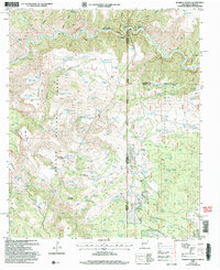
2005 Map of Harden Cienega
USGS Topo · Published 2006About this map
Harden Cienega sits at the intersection of the Apache National Forest and Gila National Forest, straddling the high-desert borderlands where New Mexico meets Arizona. The landscape is defined by the canyon systems of the San Francisco River and a series of expansive mesas, including Antelope Mesa, Table Top Mesa, and Dix Saddle Mesa. This 2005 revision highlights a territory primarily managed for forest and range, evidenced by the numerous water storage features such as Coalson Tank and 2 O'Clock Tank that dot the drainages.
Find a feature on this map
133 named features on this map. Tap any name to fly to it.
Don’t see what you’re looking for? This feature index may not catch every label — zoom into the map to look around manually.
Map Details
Editions of this 2005 Harden Cienega Map
This is the sole edition of this map. No revisions or reprints were ever made.
Other maps of this area

1910 · Mogollon
USGS Topo · 1:125,000

1912 · Mogollon
USGS Topo · 1:125,000

1913 · Morenci
USGS Topo · 1:125,000

1915 · Morenci
USGS Topo · 1:125,000

1954 · Clifton
USGS Topo · 1:250,000

1957 · Clifton
USGS Topo · 1:250,000

1958 · Clifton
USGS Topo · 1:250,000

1962 · Clifton
USGS Topo · 1:250,000

1962 · Big Lue Mts
USGS Topo · 1:62,500
1965 · Mule Creek
USGS Topo · 1:24,000