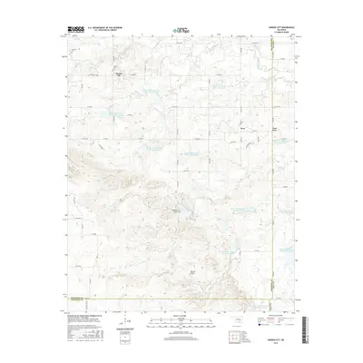
2016 Map of Harden City
USGS Topo · Published 2016About this map
Harden City and the neighboring settlements of Jesse and East Jesse anchor this 2016 survey of the Oklahoma landscape where Pontotoc, Coal, and Johnston counties meet. The terrain is defined by a dense network of water management sites, specifically the numerous Upper Clear Boggy Creek reservoirs, such as Upper Clear Boggy Cr Site 23 Reservoir and Upper Clear Boggy Cr Number 19 Reservoir. These features, alongside named peaks like Gobbler Knob and Biscuit Knob, illustrate the region's managed hydrology and topographical relief.
Find a feature on this map
59 named features on this map. Tap any name to fly to it.
Don’t see what you’re looking for? This feature index may not catch every label — zoom into the map to look around manually.
Map Details
Editions of this 2016 Harden City Map
This is the sole edition of this map. No revisions or reprints were ever made.
Other maps of this area

1896 · Coalgate
USGS Topo · 1:125,000

1899 · Coalgate
USGS Topo · 1:125,000

1899 · Atoka
USGS Topo · 1:125,000

1900 · Atoka
USGS Topo · 1:125,000

1900 · Coalgate
USGS Topo · 1:125,000

1901 · Stonewall
USGS Topo · 1:125,000

1901 · Tishomingo
USGS Topo · 1:125,000

1957 · Stonewall
USGS Topo · 1:24,000

1957 · Ardmore
USGS Topo · 1:250,000

1958 · Lula
USGS Topo · 1:24,000