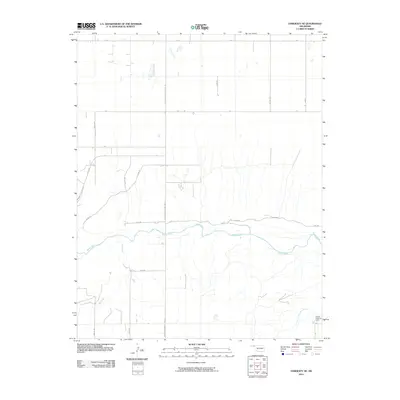
2010 Map of Hardesty NE
USGS Topo · Published 2010About this map
The Beaver River meanders across this landscape in the Oklahoma Panhandle, carving a wide valley through the high plains of Texas County. This 2010 survey illustrates a region defined by a rigid grid of rural section roads, including Mile 51 Rd and Mile 56 Rd, which facilitate transport through the agricultural expanses. In the southeast corner, the Gibson Assembly Camp stands as a notable landmark near the river's edge, while Dry Creek feeds into the main waterway from the south. The transportation network is anchored by Adams Road County Hwy 14, which serves as a primary north-south artery. The map provides a clear view of the drainage patterns and land management typical of this semi-arid region, where water sources like the Beaver River remain central to the geography.
Find a feature on this map
20 named features on this map. Tap any name to fly to it.
Don’t see what you’re looking for? This feature index may not catch every label — zoom into the map to look around manually.
Map Details
Editions of this 2010 Hardesty NE Map
This is the sole edition of this map. No revisions or reprints were ever made.
Other maps of this area

1954 · Perryton
USGS Topo · 1:250,000

1958 · Perryton
USGS Topo · 1:250,000

1967 · Hooker
USGS Topo · 1:24,000

1967 · Adams
USGS Topo · 1:24,000

1968 · Hardesty
USGS Topo · 1:24,000

1968 · Optima Dam
USGS Topo · 1:24,000

1968 · Hardesty SE
USGS Topo · 1:24,000

1968 · Hardesty NE
USGS Topo · 1:24,000

1973 · Bryans Corner SW
USGS Topo · 1:24,000

1973 · Red Horse Creek
USGS Topo · 1:24,000