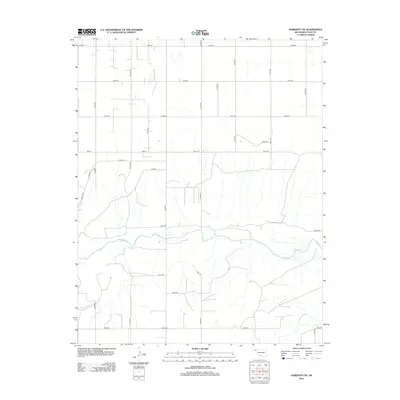
2012 Map of Hardesty NE
USGS Topo · Published 2012About this map
The Beaver River winds through the southern portion of this high plains landscape, defining the primary drainage for the surrounding section-line grid. This 2012 survey illustrates the systematic rural development of Texas County, where the terrain is dominated by an extensive network of mile-roads such as Mile 52 Rd and Mile 54 Rd. The intermittent channel of Dry Cr feeds into the river from the south, cutting across a landscape largely organized for agriculture and transport. Regional connectivity is established by north-south arteries like Co Hwy 14 and Co Hwy 12, which serve as the primary conduits between the dispersed homesteads and the larger settlements beyond the map's borders.
Find a feature on this map
29 named features on this map. Tap any name to fly to it.
Don’t see what you’re looking for? This feature index may not catch every label — zoom into the map to look around manually.
Map Details
Editions of this 2012 Hardesty NE Map
This is the sole edition of this map. No revisions or reprints were ever made.
Other maps of this area

1954 · Perryton
USGS Topo · 1:250,000

1958 · Perryton
USGS Topo · 1:250,000

1967 · Hooker
USGS Topo · 1:24,000

1967 · Adams
USGS Topo · 1:24,000

1968 · Hardesty
USGS Topo · 1:24,000

1968 · Optima Dam
USGS Topo · 1:24,000

1968 · Hardesty SE
USGS Topo · 1:24,000

1968 · Hardesty NE
USGS Topo · 1:24,000

1973 · Bryans Corner SW
USGS Topo · 1:24,000

1973 · Red Horse Creek
USGS Topo · 1:24,000