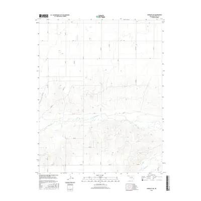
2016 Map of Hardesty NE
USGS Topo · Published 2016About this map
The Beaver River winds through this High Plains landscape in Texas County, carving a wide valley across the central portion of the sheet. This 2016 survey documents the rural character of the Oklahoma Panhandle, where the land is strictly organized by a regular section-line road grid. North of the river, the terrain is relatively flat, marked by local identifiers such as Mile 51, Mile 52, and Co Hwy 12. South of the river, the topography becomes more complex as the land breaks into the drainage systems of Dry Cr and Palo Duro Cr. These tributaries have eroded the plateau into a network of draws and ridges, creating a distinct contrast with the agricultural plains above. This map is particularly useful for identifying contemporary land divisions and the specific placement of rural routes like E0260 Rd and Co Rd 54.
Find a feature on this map
30 named features on this map. Tap any name to fly to it.
Don’t see what you’re looking for? This feature index may not catch every label — zoom into the map to look around manually.
Map Details
Editions of this 2016 Hardesty NE Map
This is the sole edition of this map. No revisions or reprints were ever made.
Other maps of this area

1954 · Perryton
USGS Topo · 1:250,000

1958 · Perryton
USGS Topo · 1:250,000

1967 · Hooker
USGS Topo · 1:24,000

1967 · Adams
USGS Topo · 1:24,000

1968 · Hardesty
USGS Topo · 1:24,000

1968 · Optima Dam
USGS Topo · 1:24,000

1968 · Hardesty SE
USGS Topo · 1:24,000

1968 · Hardesty NE
USGS Topo · 1:24,000

1973 · Bryans Corner SW
USGS Topo · 1:24,000

1973 · Red Horse Creek
USGS Topo · 1:24,000