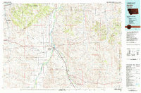
1981 Map of Hardin
USGS Topo · Published 1981About this map
Hardin stands at the confluence of the Bighorn River and the sweeping coulees of Big Horn County, serving as a vital central hub in this early 1980s landscape. The map captures a region defined by its historical weight and industrial transitions, featuring the Custer Battlefield National Monument to the south alongside the Sarpy Creek Mine to the east. Transportation and irrigation patterns are clearly visible, with the Burlington Northern railroad and Interstate 90 cutting through the valley, connecting outlying settlements like Pompeys Pillar and Garryowen. The intricate network of seasonal drainages such as Wagon Box Coulee and Medicine Tail Coulee illustrates the complex drainage basin of the Little Bighorn River, providing a detailed view of the terrain before later development altered these rural corridors.
Find a feature on this map
68 named features on this map. Tap any name to fly to it.
Don’t see what you’re looking for? This feature index may not catch every label — zoom into the map to look around manually.
Map Details
Editions of this 1981 Hardin Map
This is the sole edition of this map. No revisions or reprints were ever made.
Other maps of this area

1893 · Huntley
USGS Topo · 1:125,000

1894 · Rosebud
USGS Topo · 1:125,000

1894 · St. Xavier
USGS Topo · 1:125,000

1894 · Fort Custer
USGS Topo · 1:125,000

1901 · Rosebud
USGS Topo · 1:125,000

1901 · St. Xavier
USGS Topo · 1:125,000

1915 · Spenceville
USGS Topo · 1:31,680

1954 · Billings
USGS Topo · 1:250,000

1954 · Hardin
USGS Topo · 1:250,000

1954 · Forsyth
USGS Topo · 1:250,000