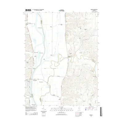
2015 Map of Hardin
USGS Topo · Published 2015About this map
The Illinois River serves as the central artery and natural boundary for this region, separating Hardin and East Hardin as it flows past a complex network of islands and chutes. The landscape is defined by the transition from the river’s alluvial bottomlands, featuring Godar Swamp and Horse Shoe Lake, to the elevated ridges of Pea Ridge and Zerby Hill. The confluence of Macoupin Creek with the Illinois creates a distinctive geography of islands, including Macoupin Island and Tip Island. Local history is preserved in numerous family and community cemeteries such as Varble Cem and Reddish-Dunham Ford Cem, which are scattered throughout the hollows. Evidence of early habitation is visible at Witachek Mound, while the transportation network is anchored by the Great River Rd and historic crossings like the Reddish Bridge.
Find a feature on this map
81 named features on this map. Tap any name to fly to it.
Don’t see what you’re looking for? This feature index may not catch every label — zoom into the map to look around manually.
Map Details
Editions of this 2015 Hardin Map
This is the sole edition of this map. No revisions or reprints were ever made.
Other maps of this area

1924 · Roodhouse
USGS Topo · 1:62,500

1926 · Roodhouse
USGS Topo · 1:62,500

1930 · Pearl
USGS Topo · 1:62,500

1930 · Hardin
USGS Topo · 1:62,500

1930 · Jerseyville
USGS Topo · 1:62,500

1933 · Jerseyville
USGS Topo · 1:62,500

1934 · Hardin
USGS Topo · 1:62,500

1938 · Hardin
USGS Topo · 1:62,500

1948 · Quincy
USGS Topo · 1:250,000

1950 · Pearl
USGS Topo · 1:62,500