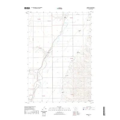
2020 Map of Hardin SW
USGS Topo · Published 2020About this map
The Bighorn River carves a wide path through this portion of Big Horn County, defining a landscape of complex drainage systems and irrigation infrastructure. The Big Horn Canal runs parallel to the river's eastern bank, illustrating the critical role of water management in this Montana valley. To the west, Woody Cr flows through the township blocks, while the eastern bluffs are deeply etched by numerous named coulees. These landforms, including Whiskey Coulee, Wild Horse Coulee, and Halfway House Coulee, suggest a history of ranching and travel through the breaks. Local transit is facilitated by a network of county roads such as Co Rd 313 and Crow-St Xavier Rd, which connect the scattered homesteads and agricultural operations along the river bottom to the higher grazing lands above.
Find a feature on this map
21 named features on this map. Tap any name to fly to it.
Don’t see what you’re looking for? This feature index may not catch every label — zoom into the map to look around manually.
Map Details
Editions of this 2020 Hardin SW Map
This is the sole edition of this map. No revisions or reprints were ever made.
Other maps of this area

1894 · St. Xavier
USGS Topo · 1:125,000

1894 · Fort Custer
USGS Topo · 1:125,000

1901 · St. Xavier
USGS Topo · 1:125,000

1954 · Hardin
USGS Topo · 1:250,000

1957 · Hardin
USGS Topo · 1:250,000

1958 · Hardin
USGS Topo · 1:250,000

1960 · St Xavier
USGS Topo · 1:24,000

1960 · Walker Hill
USGS Topo · 1:24,000

1960 · St Xavier NE
USGS Topo · 1:24,000

1960 · Hardin
USGS Topo · 1:24,000