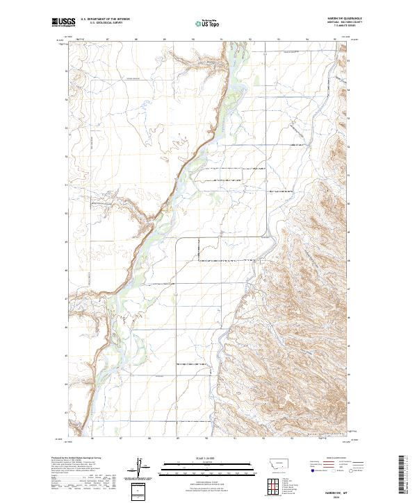
2024 Map of Hardin SW
USGS Topo · Published 2024About this map
The Bighorn River cuts a prominent path through this Big Horn County landscape, framed by a complex network of seasonal drainages and irrigation infrastructure. The Big Horn Canal runs parallel to the river's eastern bank, illustrating the vital role of water management in this Montana valley. The surrounding terrain is deeply etched by numerous named coulees, including Halfway House Coulee, Wild Horse Coulee, and Good Horse Coulee, which suggest the historic importance of these landmarks for navigation and livestock in an open range.
Find a feature on this map
21 named features on this map. Tap any name to fly to it.
Don’t see what you’re looking for? This feature index may not catch every label — zoom into the map to look around manually.
Map Details
Editions of this 2024 Hardin SW Map
This is the sole edition of this map. No revisions or reprints were ever made.
Other maps of this area

1894 · St. Xavier
USGS Topo · 1:125,000

1894 · Fort Custer
USGS Topo · 1:125,000

1901 · St. Xavier
USGS Topo · 1:125,000

1954 · Hardin
USGS Topo · 1:250,000

1957 · Hardin
USGS Topo · 1:250,000

1958 · Hardin
USGS Topo · 1:250,000

1960 · St Xavier
USGS Topo · 1:24,000

1960 · Walker Hill
USGS Topo · 1:24,000

1960 · St Xavier NE
USGS Topo · 1:24,000

1960 · Hardin
USGS Topo · 1:24,000