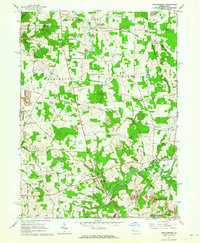
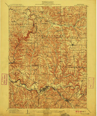
1961 Map of Harlansburg
USGS Topo · Published 1964About this map
Slippery Rock Creek winds through the southern portion of this landscape, anchoring a region defined by small rural settlements and extensive public grounds like State Game Lands No 151. In the early 1960s, the village of Harlansburg served as a central hub for the surrounding townships of Scott and Washington. The map reveals a transition from agricultural use to extraction, with several Strip Mine operations and a Tipple scattered across the northern sections. Local education and community life are marked by landmarks such as the Jackson School and East Lawrence Sch, while recreational sites like Camp Rentz and Deep Valley Camp occupy the wooded bends of Slippery Rock Creek. Traceable remnants of earlier transportation, including an Old RR Grade in the northeast, offer a window into the changing rail and road network of Lawrence County at this time.
Find a feature on this map
64 named features on this map. Tap any name to fly to it.
Don’t see what you’re looking for? This feature index may not catch every label — zoom into the map to look around manually.
Map Details
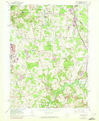
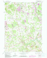
Editions of this 1961 Harlansburg Map
3 editions found
Other maps of this area

1902 · New Castle
USGS Topo · 1:62,500

1904 · Newcastle
USGS Topo · 1:62,500

1905 · Neshannock
USGS Topo · 1:62,500

1907 · Neshannock
USGS Topo · 1:62,500
1908 · Zelienople
USGS Topo · 1:62,500
1910 · Zelienople
USGS Topo · 1:62,500

1913 · Mercer
USGS Topo · 1:62,500
1939 · Mercer
USGS Topo · 1:62,500

1943 · Mercer
USGS Topo · 1:62,500

1950 · Cleveland
USGS Topo · 1:250,000
Featured Places
- Plain Grove Township, PA
- Worth Township, PA
- Liberty Township, PA
- Springfield Township, PA
- Brent, Plain Grove Township