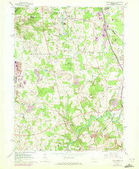
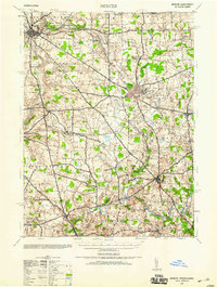
1961 Map of Harlansburg
USGS Topo · Published 1972About this map
Slippery Rock Creek carves a winding path through the southern half of this landscape, anchoring the settlements of Harlansburg and Rockville. The terrain reflects a mix of conservation and extraction, with State Game Lands No 151 occupying large tracts alongside active Strip Mine operations and industrial history. An Old RR Grade in the northeast corner near Brent and Drake suggests the era of rail-based transport that once connected these rural townships.
Find a feature on this map
50 named features on this map. Tap any name to fly to it.
Don’t see what you’re looking for? This feature index may not catch every label — zoom into the map to look around manually.
Map Details
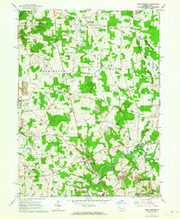
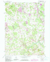
Editions of this 1961 Harlansburg Map
3 editions found
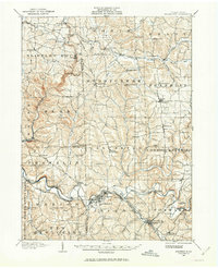
Other maps of this area

1902 · New Castle
USGS Topo · 1:62,500

1904 · Newcastle
USGS Topo · 1:62,500

1905 · Neshannock
USGS Topo · 1:62,500

1907 · Neshannock
USGS Topo · 1:62,500
1908 · Zelienople
USGS Topo · 1:62,500
1910 · Zelienople
USGS Topo · 1:62,500

1913 · Mercer
USGS Topo · 1:62,500
1939 · Mercer
USGS Topo · 1:62,500

1943 · Mercer
USGS Topo · 1:62,500

1950 · Cleveland
USGS Topo · 1:250,000
Featured Places
- Plain Grove Township, PA
- Worth Township, PA
- Liberty Township, PA
- Springfield Township, PA
- Brent, Plain Grove Township