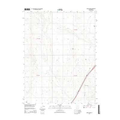
2014 Map of Harley Dome
USGS Topo · Published 2014About this map
Harley Dome and the Harley Dome Gas Field characterize this high-desert landscape in the eastern reaches of Grand County. The terrain is deeply defined by the drainage systems of Westwater Cr and Sulphur Cr, which carve through the arid geography of Grand Valley. This 2014 survey documents the industrial footprint of energy extraction alongside regional transportation hubs like the Westwater Airport. Topographic details reveal the complex network of draws and washes, including Coal Draw and Bryson Wash, illustrating the rugged erosional patterns of the Colorado Plateau. The map serves as a precise record of late-modern land use, showing how resource infrastructure and transit corridors integrate with the distinct township and range boundaries of t18s r25e and t19s r25e.
Find a feature on this map
12 named features on this map. Tap any name to fly to it.
Don’t see what you’re looking for? This feature index may not catch every label — zoom into the map to look around manually.
Map Details
Editions of this 2014 Harley Dome Map
This is the sole edition of this map. No revisions or reprints were ever made.
Other maps of this area

1885 · East Tavaputs
USGS Topo · 1:250,000

1954 · Westwater 4 SW
USGS Topo · 1:24,000

1956 · Westwater 4 SE
USGS Topo · 1:24,000

1956 · Grand Junction
USGS Topo · 1:250,000

1959 · Grand Junction
USGS Topo · 1:250,000

1960 · Grand Junction
USGS Topo · 1:250,000

1962 · Grand Junction
USGS Topo · 1:250,000

1964 · Grand Junction
USGS Topo · 1:250,000

1965 · Grand Junction
USGS Topo · 1:250,000
1970 · Harley Dome
USGS Topo · 1:24,000