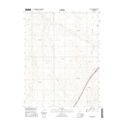
2017 Map of Harley Dome
USGS Topo · Published 2017About this map
Grand Valley defines this arid landscape of the high desert along the Utah-Colorado border. This modern survey illustrates a topography of deep washes and prominent ridges, most notably the namesake Harley Dome and the rising elevations of the Book Cliff Ridge Rd. The area is drained by seasonal watercourses including Westwater Cr and Sulphur Cr, which cut through the terrain south of the Coal Draw. Infrastructure in this sparsely populated region is dominated by transportation corridors and technical facilities, including the Westwater Airport and a network of arterial roads like Pechula Rd and the Mac Intyre Cutoff. The presence of the Railroad and Harley Dome Rd in the southeastern corner highlights the area's role as a transit link through the rugged backcountry of Grand County.
Find a feature on this map
22 named features on this map. Tap any name to fly to it.
Don’t see what you’re looking for? This feature index may not catch every label — zoom into the map to look around manually.
Map Details
Editions of this 2017 Harley Dome Map
This is the sole edition of this map. No revisions or reprints were ever made.
Other maps of this area

1885 · East Tavaputs
USGS Topo · 1:250,000

1954 · Westwater 4 SW
USGS Topo · 1:24,000

1956 · Westwater 4 SE
USGS Topo · 1:24,000

1956 · Grand Junction
USGS Topo · 1:250,000

1959 · Grand Junction
USGS Topo · 1:250,000

1960 · Grand Junction
USGS Topo · 1:250,000

1962 · Grand Junction
USGS Topo · 1:250,000

1964 · Grand Junction
USGS Topo · 1:250,000

1965 · Grand Junction
USGS Topo · 1:250,000
1970 · Harley Dome
USGS Topo · 1:24,000