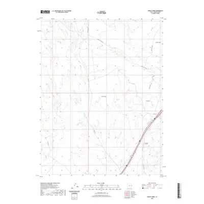
2020 Map of Harley Dome
USGS Topo · Published 2020About this map
Grand Valley defines the landscape of this eastern Utah desert, where drainage systems like Westwater Cr, Bryson Wash, and Sulphur Cr carve out the arid terrain. The map captures a high-desert crossroads at Harley Dome, where the interstate corridor meets local transport routes such as Harley Dome Rd and Harleys Dome. Transportation and infrastructure are central to this 2020 record, featuring the Westwater Airport and a prominent Railroad line cutting through the northeast. To the north, the elevation rises toward the Book Cliff Ridge Rd, while industrial history is signaled by the naming of Coal Draw. The road network, including the Mac Intyre Cutoff and Pechula Rd, illustrates the continued utility of these remote desert pathways for range management and resource access.
Find a feature on this map
15 named features on this map. Tap any name to fly to it.
Don’t see what you’re looking for? This feature index may not catch every label — zoom into the map to look around manually.
Map Details
Editions of this 2020 Harley Dome Map
This is the sole edition of this map. No revisions or reprints were ever made.
Other maps of this area

1885 · East Tavaputs
USGS Topo · 1:250,000

1954 · Westwater 4 SW
USGS Topo · 1:24,000

1956 · Westwater 4 SE
USGS Topo · 1:24,000

1956 · Grand Junction
USGS Topo · 1:250,000

1959 · Grand Junction
USGS Topo · 1:250,000

1960 · Grand Junction
USGS Topo · 1:250,000

1962 · Grand Junction
USGS Topo · 1:250,000

1964 · Grand Junction
USGS Topo · 1:250,000

1965 · Grand Junction
USGS Topo · 1:250,000
1970 · Harley Dome
USGS Topo · 1:24,000